Save St.Giles
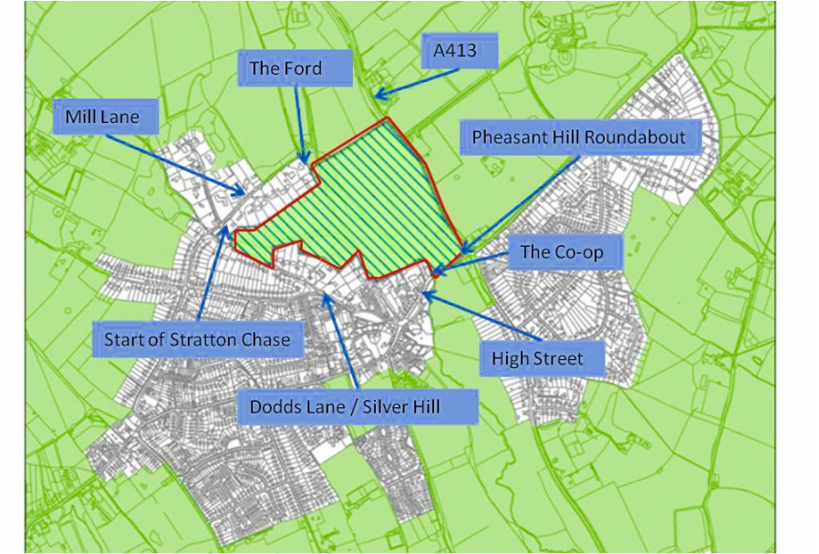
Map Of Area identified as an 'Option' for 'possible' development by Chiltern District Council.

We have added local landmarks to help people who say the map issued by the Council is very confusing,
The County Council map had no street names, no landmarks, the hatched area 'presented for possible development' is coloured green so it actually looks like an extension of green fields.
We have also zoomed in on the village as the Council MAP as published in the Local Plan was so wide it made the hatched area appear insignificant when it is actually an area that if used for housing to current Government recommendations could increase the 'built on' area of our village and population by by approximately 30%.
