How much of Upper Stone Meadow development option is available?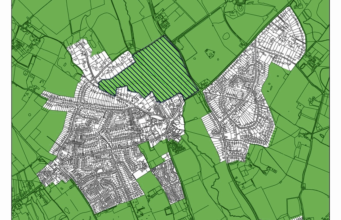
Chiltern and Bucks County Council have hatched only one area for possible development in Chalfont St Giles in their Local Plan published recently. 'Upper Stone Meadow' is presented to the public as a possible development site but Chiltern and Bucks District Councils did not declare any interest in this parcel of land when the Local Plan was published.
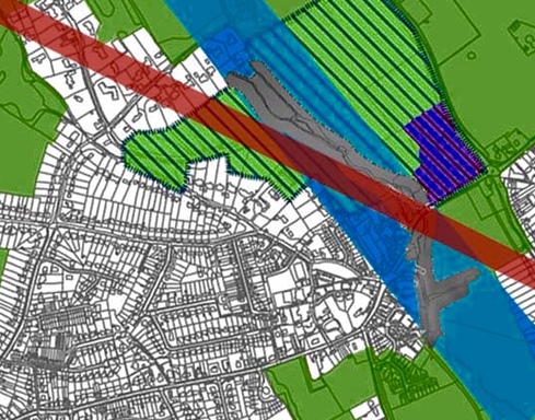
We have since discovered that 'Upper Stone Meadow' is owned by Chiltern District Council who would benefit significantly if they themselves downgraded the agricultural land in GreenBelt and an AONB for prime development. It was purchased by CDC from Bucks CC in January 2002 (See Land Registry details HERE). Much of that land hatched on p40 of the Local Plan is not available and therefore not deliverable. The majority of the parcel of hatched land is either privately owned, contains Listed Buildings, ancient trees, flood plain or is land reserved legally for access by HS2 . So in our view the proposal is not viable. A wide swathe of land is designated flood plain. This Page shows the width of the official flood plain but locals know that it is common for the valley to flood wider and gather into lakes for months in these fields. The HS2 Twin Bore Tunnel runs directly under the proposed development area. We are still waiting to hear back from HS2 as to whether it is legal to build or develop at all above a proposed tunnel (we know it is not possible with Cross Rail). HS2 Ltd have already set aside land on the proposed development site and have legal access to that land as a 'Protection Safe Guard Area' see MAP taken from HS2 safeguarding map Ref SG-01-017. Geologist Dr Haydon Bailey went before the HS2 Select Committee to express his concern that the crown of the train tunnel close to St Giles has only 6m of competent chalk above it which he considers to be a serious threat of ground failure. This is not ideal ground in which to dig building foundations, sewers, drainage ducts for either houses or commercial buildings. Please review this slideshow which reveals the different elements that effect the hatched area on p40 of the Local Plan and make it unsuitable for development on any scale. Much of the proposed 'hatched' land also has 'covenants' placed upon it which we are looking in to. See Pink shaded area and details of purchase and restrictions and Land Registry Map. In addition more Land has been rejected for development following a HELAA Assessment in the village. Area 0242 on this MAP is included in the Council development area. Taking most of the above restrictions above (not showing protected trees or HELAA ) into account the restrictions on developing the site are huge, see below. (The Stone HS2 Tunnel Flood Plain HS2 access) |